Browse RV Dump Stations By Location
Venture into cities with the assurance that your needs are covered. Find city-specific RV dump stations that offer convenient and easy-to-access services. Because even when you’re soaking in the city lights, your RV’s cleanliness should never be a compromise. Seeking a dump station with fresh water supply? Or how about a spot with waste disposal and recycling facilities? Perhaps a pet-friendly location? Whatever your requirement, you’re sure to find a dump station that meets your needs in our directory. Every listing includes a thorough review, pictures, and essential information about facilities, pricing, and operating hours.
Begin your clean journey today! Discover your ideal RV dump station from our wide variety of options and keep the adventure rolling. Because with us, every journey is a joyride. Safe and clean travels to you!
Looking for a spot to refresh your RV? You can conveniently navigate our detailed directory by selecting the country, state/region, or city you’re exploring. And if you’re feeling bold, why not let serendipity guide your next pit stop?
Is the Sunshine State on your horizon? Or are you winding your way up the Rockies? No matter where your journey is leading you, we have a selection of easily accessible dump stations for every state, ensuring you’re never left in a bind.
From the pristine landscapes of Canada to the vibrant expanses of Mexico, our directory boasts an array of RV dump stations for your every need. Go global, or stay local and keep your home-on-wheels at its best, no matter where the road takes you.
Find Dump Station By Location
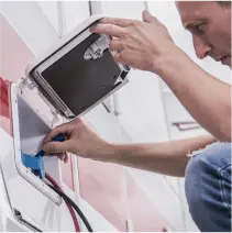
Easy to Install and Ready to Use